Z Height
A PowerCADD drawing consists of two-dimensional objects, however PowerCADD provides the capability to store additional information with each object. The Z height of an object is stored this way, and it is optional. Thus, most objects will not have a Z height at all.
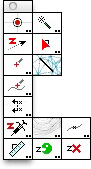
To get started, use the Z Needle to assign a Z height to an object in the drawing. Once you do this, many of the tools in TopoTools will suddenly come alive when they ‘see’ the Z height of the object.
Dimension Point Objects
This is a new type of object which shows the X and/or Y location of the object in the drawing as dimension text. When the object is moved, the dimension text changes to the current X and Y location. The dimensions may be single or dual dimensions. The Dimension Point tool and Datum Dimension tool place dimension point objects in the drawing. These objects do not have a Z height, but you can use the Z Needle tool to give them a Z height.
Dimension point objects have a single marker, which can be literally any PowerCADD object, including groups of objects, pictures, etc. They are always a fixed size and are normally centered on the object, but not always—as in the case of Topo Point Objects.
These are a special type of dimension point objects which always have a Z height. As placed by TopoTools, the markers will be a reference point, or a vertical or diagonal cross.
Topo point objects may show only the Z height as dimension text, and may also have additional text for the survey point number and a description. While you may edit the survey point number and description with the Text tool, this will not work well because the text will be replaced with the original internally-stored point number and description.
The topo point dimensions may be single or dual dimensions. The topo point object may have a leader, which can be a polygon or a smooth B-spline.